3D Laser Scanning · Levantamiento Láser 3D
High-precision 3D laser scanning & reality capture
Terrestrial laser scanning that captures massive geospatial and geometric data with millimetric accuracy — the foundation of every Scan-to-BIM and Digital Twin.
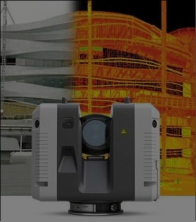
Our 3D laser scanning (reality capture) service digitizes facilities, industrial plants, façades, terrains and complex mechanical parts with millimetric precision. We then clean, register and optimize the data into a ready-to-use point cloud.
On-site surveys are available across Mexico and, for selected projects, in the United States. The resulting point cloud feeds directly into our Scan-to-BIM and Digital Twin workflows — eliminating field errors and reducing project times.
What it includes
Capabilities & scope
Terrestrial laser scanning
Massive, high-precision capture of facilities, plants and terrains.
Reverse-engineering scans
High-detail scanning of mechanical parts and complex geometries (0.5–4 m²).
Point cloud processing
Cleaning, registration, indexing and delivery of optimized raw data.
Ready for BIM
Point clouds prepared for Scan-to-BIM, Revit, Plant 3D and Digital Twins.
Deliverables
What you receive
- ▸Registered & optimized point cloud
- ▸Cleaned raw scan data (indexed)
- ▸Coordinate & control reference
- ▸Discrepancy report (drawings vs. as-built)
- ▸Hand-off ready for BIM modeling
Request a tailored quote
Tell us about your asset and required scope. For qualified projects we offer a free Proof of Concept.
FAQ
Frequently asked questions
Where do you provide on-site scanning?+
On-site laser scanning is available across Mexico and, in selected cases, in the United States. Remote modeling from existing point clouds is available worldwide.
What precision do you achieve?+
Our terrestrial laser scanning delivers millimetric precision, ideal for as-built engineering, reverse engineering and clash-free Scan-to-BIM.
What do I receive after the survey?+
A registered, optimized point cloud plus indexed raw data, ready to be converted into BIM models or Digital Twins.
Request a quote
Prefer a faster channel? Ask about our free Proof of Concept for qualified projects.